 Situational awareness is a prerequisite for good decision-making in any CSDP mission or operation. In order to provide operation commanders with optimal capabilities in this domain, EDA Member States in 2014 launched GISMO, the ‘Geospatial Information to Support decision Making in Operations’ project. Since then and working in partnership with the EU Satellite Centre (EU SatCen), GISMO has produced a first operational output in the form of ‘GeohuB’, a software application which allows for the safe and reliable sharing of geospatial information (GI) within a mission’s operational headquarter.
|

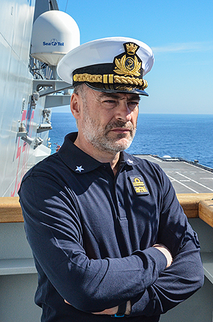
Rear Admiral Enrico Credendino
Commander EUNAVFOR Med Operation Sophia
|
After a successful field trial, GeohuB was successfully deployed in November 2017 to the Italian Operation Headquarters, Rome, in support of EU Naval Force Mediterranean (EUNAVFOR MED). In practical terms, this means that operation participants with access to the classified mission network of EUNAVFOR MED’s operational headquarters in Rome can upload, share and manage geospatial data related to the operation (GeohuB is accessible through a normal web browser with a user-friendly interface).
Last June, GISMO started the transition of the GeohuB application from the current status of Initial Operating Capability (IOC) to Full Operating Capability (FOC) by the summer. A move much welcomed by Rear Admiral Enrico Credendino, the Commander of EUNAVFOR Med Operation Sophia. “Within the operational activity, the GEOHUB system is an effective service to support geospatial information. We aim to increase the use of this tool more and more with the intention of reaching the full operational capability before summer 2019”, he said.
Last September, a new milestone was reached when the first training session was provided by EU SatCen staff to OHQ Sophia and training tutorials were handed over to GeohuB users on the ground in the framework of EDA project GISMO.
Interview: “A common geospatial solution is paramount”
After the GeohuB training session, we spoke to Italian Lieutenant Colonel Claudio Panizzi who is GEO Officer at operation ‘Sophia’ (EUNAVFOR Med).
GISMO GeohuB is a Content Management System that facilitates the access to space-based information integrated with geospatial data in an Operational Headquarters environment. How important is space-based information and its integration into a common geospatial dataset for EUNAVFOR MED?
Lt.Col. Claudio Panizzi: Almost all of the information that is managed inside an operation has a geospatial component. Reports are linked to locations, ships are located somewhere, the patrolling routes cover a given area, etc. The need to integrate all this information into a common geospatial solution is paramount to ensure that we are all fighting off the same map in this operation. An integrated approach as provided by GeohuB allows us to combine intelligence from different sources including space assets. Space assets are an operational resource able to provide answers worldwide, reliably within strict time margins. Accessing such resources and combining it with other intelligence sources enhance our capacity for decision making.
In very practical terms, what are the main operational benefits of the GISMO GeohuB System, even though it is still only at an initial stage of operational capability, and what kind of impact it has on operation SOPHIA?
Lt.Col. Claudio Panizzi: The highest benefit is to allow all branches of the operation to share a common view, empowering the staff to access data generated by other branches on their own, streamlining processes and easing dec
ision making. In addition, having a common pool of information increases the safety and security of decision relying on geospatial data.
Would you recommend other CSDP Missions and Operations or even the European External Action Service (EEAS) to use the system?
Lt.Col. Claudio Panizzi: The use of a system able to operate inside the classified network allows to have an integrated vision. The use of open sources is important, but it is just another source of information. The real benefit for the operation comes from having all the sources in one tool that allows to mix the unclassified layer of geographical information with the classified information generated by the mission. This can only be achieved with operational tools inside the classified network.
One of the main objectives of the GISMO GeohuB is to support the decision-making process on the basis of updated situational awareness informed by space-based information. Based on the experience you’ve made so far with the system, would you say that there is room for new technologies, such as Artificial Intelligence (AI), to further improve the tool?
Lt.Col. Claudio Panizzi: As said before, the GISMO GehuB is a decision-making process oriented software. It provides, if required, a wide geospatial vision of the Area of Operations related by specific thematic overlapped layers and information.
In addition, to improve the aim of the product, we can suggest to develop remote sensing tools finalized to execute more autonomous analysis, such as change detection (to investigate day by day the development of specific situations) in order to provide more complete answers if specific and more localized crisis situations required it.
GISMO GeohuB
So far, the GISMO GeohuB has been deployed:
- since November 2017 to the Italian Operation Headquarters, Rome, in support of EU Naval Force Mediterranean (EUNAVFOR MED)
- in support of the MultiLayer 2016 (ML16) exercise as a tool for GI sharing among the different actors in the exercise (Brussels, EU OHQ in Postdam, FHQ in Strasbourg and EU delegation in Kampala)
- in support of the EUMM Georgia where the GeohuB is becoming a fundamental piece of the daily work chain within the monitoring mission
- in support of the MILEX 2017 as a tool to access GI by the EU OHQ in Northwood
- in support of EU Parallel and Coordinated Exercise 2018 (EU PACE 18)
On the initiative of the EUMS, the GISMO GeohuB is also being evaluated as the application to share Geospatial Information within the European External Action Service (EEAS) network users.
Background
Commanders of CSDP missions and operations constantly need fast, reliable and updated geospatial information covering land, sea, airspace and cyber. Geospatial information is earth-related factual data referenced by geographic position and arranged in a coherent structure. Such data include topographic, aeronautical, hydrographic or planning information but also mapping, geo-referenced imagery, geophysical products, etc. available in either analogue or digital format. Most pieces of information have a location, and knowing and understanding these locations can be decisive in a mission commanders’ decision-making. Ever improving geospatial information has thus the potential to revolutionise the decision-making process within military missions and operations.